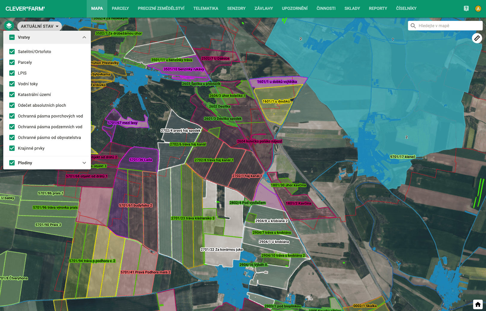
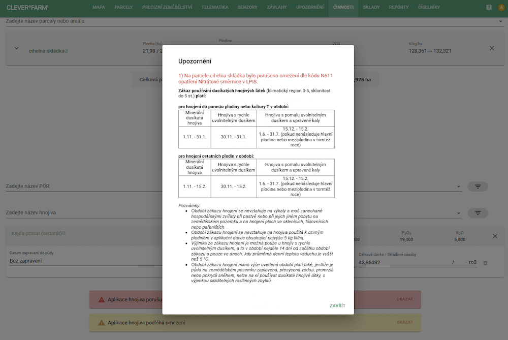
The system automatically evaluates the appropriate protection zones and possibilities of use based on the registration of the POR and the geometric boundary of the parcels, including:
- maximum allowable doses for selected POR against selected organism
- protection zone from the population
- reading from water and from the boundary of the parcel according to the use of the reducing nozzle
- protection zones of groundwater and surface waters
- subtraction from landscape features
- care of vegetation zones
- number of uses per crop
Thanks to the use of geometric control of the intersection of individual lines, the application area is calculated — including the possibility of reading the absolute area or reducing the area by a protection zone. These features will help you meet legislative requirements and at the same time better protect nature.